FLOAM was included in the ROS Noetic update, which is now available!
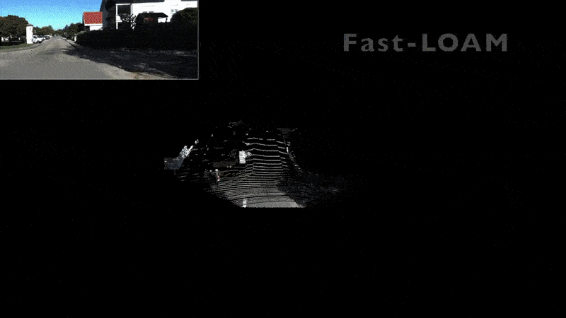
Simultaneous Localization and Mapping (SLAM) has wide robotic applications such as autonomous driving and unmanned aerial vehicles. Both computational efficiency and localization accuracy are of great importance to a good SLAM system. Existing works on LiDAR based SLAM often formulate the problem as two modules: scan-to-scan match and scan-to-map refinement, which are often solved by iterative calculation which are computationally expensive. In this work, we propose a general solution that aims to provide a computationally efficient and accurate framework for LiDAR based SLAM.
We adopt a non-iterative two-stage distortion compensation method to reduce the computational cost. For each scan input, the edge and planar features are extracted and matched to a local edge map and a local plane map separately, where the local smoothness is also considered for iterative pose optimization.
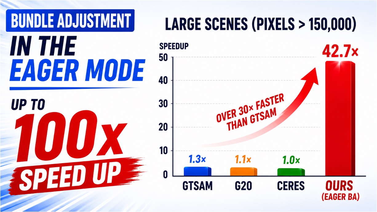
F-LOAM achieves a competitive localization accuracy with a processing rate of more than 10 Hz in the public dataset evaluation, which provides a good trade-off between performance and computational cost for practical applications. It is one of the most accurate and fastest open-sourced SLAM systems in KITTI dataset ranking.
Performance
- Computational efficiency evaluation (based on KITTI dataset):
| Dataset | ALOAM | FLOAM | Platform |
|---|---|---|---|
KITTI |
151ms | 59ms | Intel® Core™ i7-8700 CPU @ 3.20GHz |
- Localization error:
| Dataset | ALOAM | FLOAM |
|---|---|---|
KITTI sequence 00 |
0.55% | 0.51% |
KITTI sequence 02 |
3.93% | 1.25% |
KITTI sequence 05 |
1.28% | 0.93% |
Video
Source Codes
-
ROS Package: floam.
-
FLOAM was included in ROS Noetic.
Publications
-
 F-LOAM: Fast LiDAR Odometry And Mapping.IEEE/RSJ International Conference on Intelligent Robots and Systems (IROS), pp. 4390–4396, 2021.